We won't charge for your survey, if your drawings arrive after the agreed date or miss any detail from the agreed scope. (terms)
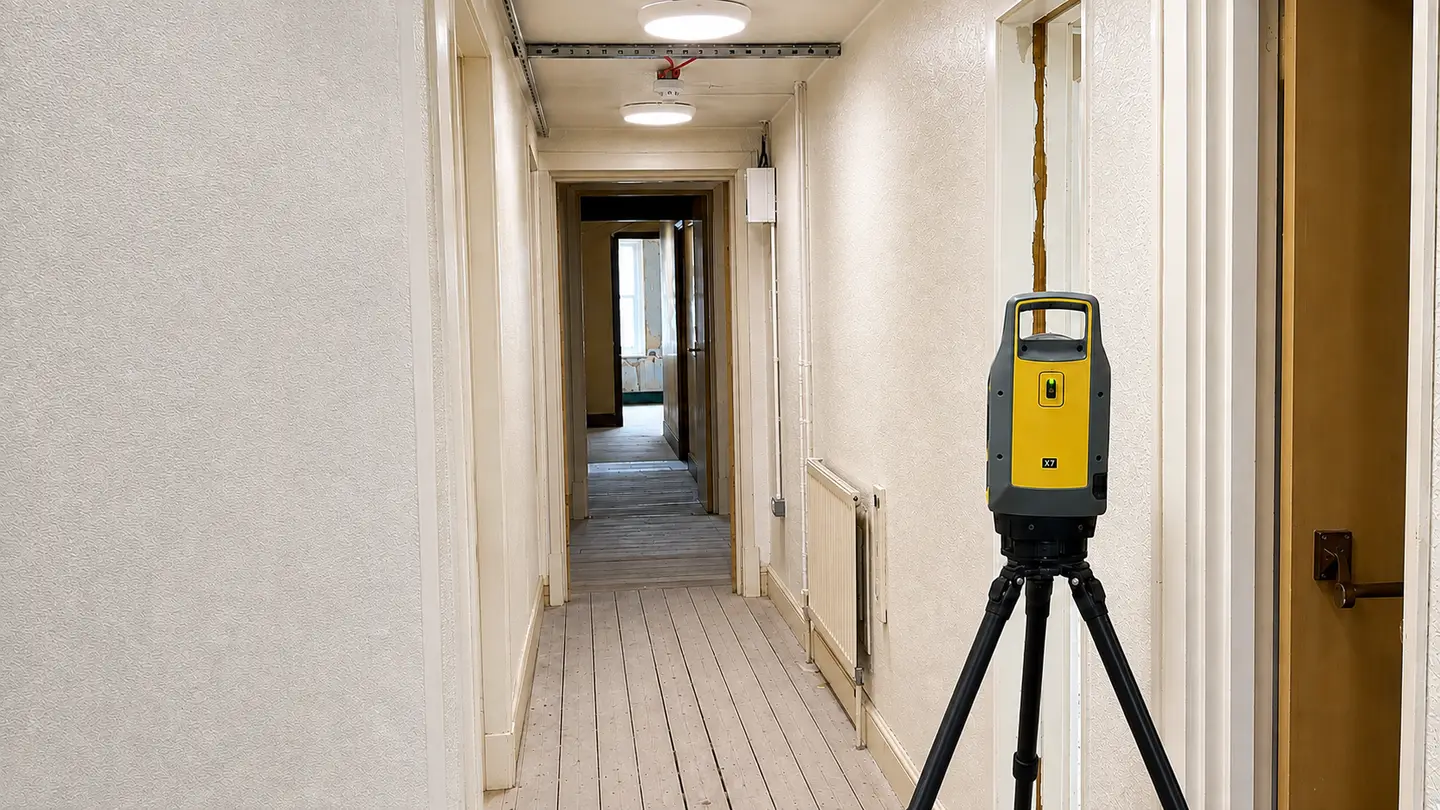
Point cloud survey — laser scanner capturing interior building data
Google ★★★★★ 5.0

Point Cloud Surveys

Accurate to ±2mm, delivered in days, so your design and planning can progress faster.

Get a Quote

±2mm Accuracy
Dense Point Cloud
Site Visits Within 2 Days
100% Money-Back Guarantee

Point Cloud Surveys

Also referred to as Scan Data, Registered Point Cloud, or RCP / E57 Data

Point Cloud is a dense dataset of measured 3D coordinates captured directly by laser scanning equipment, which is registered, georeferenced and ready to use in your workflow.

105 Surveys use laser scanning equipment to produce point cloud data as standard on our measured building surveys to better serve architects, engineers, and contractors who require survey-grade scan data.

The result is a millimetre-accurate 3D record of the existing building — captured in a single site visit, registered and delivered in the formats your workflow requires. No return visits. No guesswork.
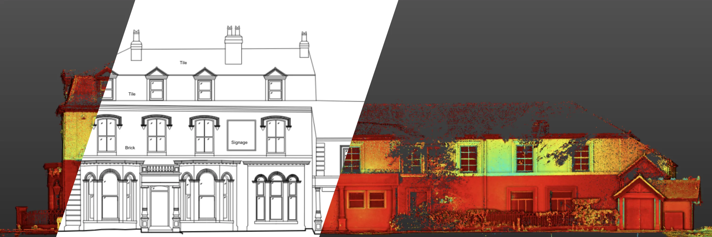
Point cloud survey data alongside elevation drawing — 105 Surveys

What Customers Say About 105 Surveys

★★★★★ Google reviews
S
Sandesh GowdaDeveloper
★★★★★
“Fast, professional and exactly what we needed — highly recommend. The quote came back the same day, the survey was completed within days of instruction, and the PDF drawings were delivered exactly when promised.”
A
Andrew RunacresProperty Developer
★★★★★
“105 Surveys provided a topographical survey and measured building survey for a development in Lancashire. They returned the survey before the date they promised which was good.”
P
Peter McChrystalHomeowner
★★★★★
“Quote was competitive and matched with clear communication from the start. Just left them and my architect to it and Lewis & Chris were in and out in a day.”
D
Darren RagnauthHomeowner
★★★★★
“I commissioned 105 Surveys to complete a measured building survey for a single-storey kitchen extension. Excellent service throughout — would not hesitate to recommend.”
P
Paul ToftVerified Reviewer
★★★★★
“Fast, efficient and professional service — highly recommended.”

Point Cloud Survey Use Cases

Point cloud data is specified across a wide range of project types, wherever precise existing geometry is needed.

Refurbishment & Fit-Out
Heritage & Listed Buildings
MEP & Services Coordination
As-Built Verification
Facade & Movement Monitoring
Refurbishment & Fit-Out Existing structure captured to millimetre accuracy so design work can proceed without repeat site visits.
Heritage & Listed Building Recording Complex, irregular geometry captured in full so alterations respect original fabric and satisfy conservation officers.
MEP & Services Coordination Structural elements and existing services checked against new design to catch clashes before they cost money on site.
As-Built Verification Completed construction checked against design intent so contracts close out on accurate record, not assumption.
Facade & Structural Movement Monitoring Repeat scans compared over time to catch movement early, before it becomes a defect or a claim.

Our Process

Same day quote
Same Day
Quote
Laser scanner
Site Visit &
Survey
Point cloud processing
Register & Process
Survey Data
Create drawings
Produce The
Required Deliverables

The Deliverables You'll Gain Are

Those Deliverables Allow You To

Start Design with Verified 3D Data
Reduce Project Risk
Maintain Accurate Spatial Data
Support Asset Management & Operations
Eliminate Return Site Visits

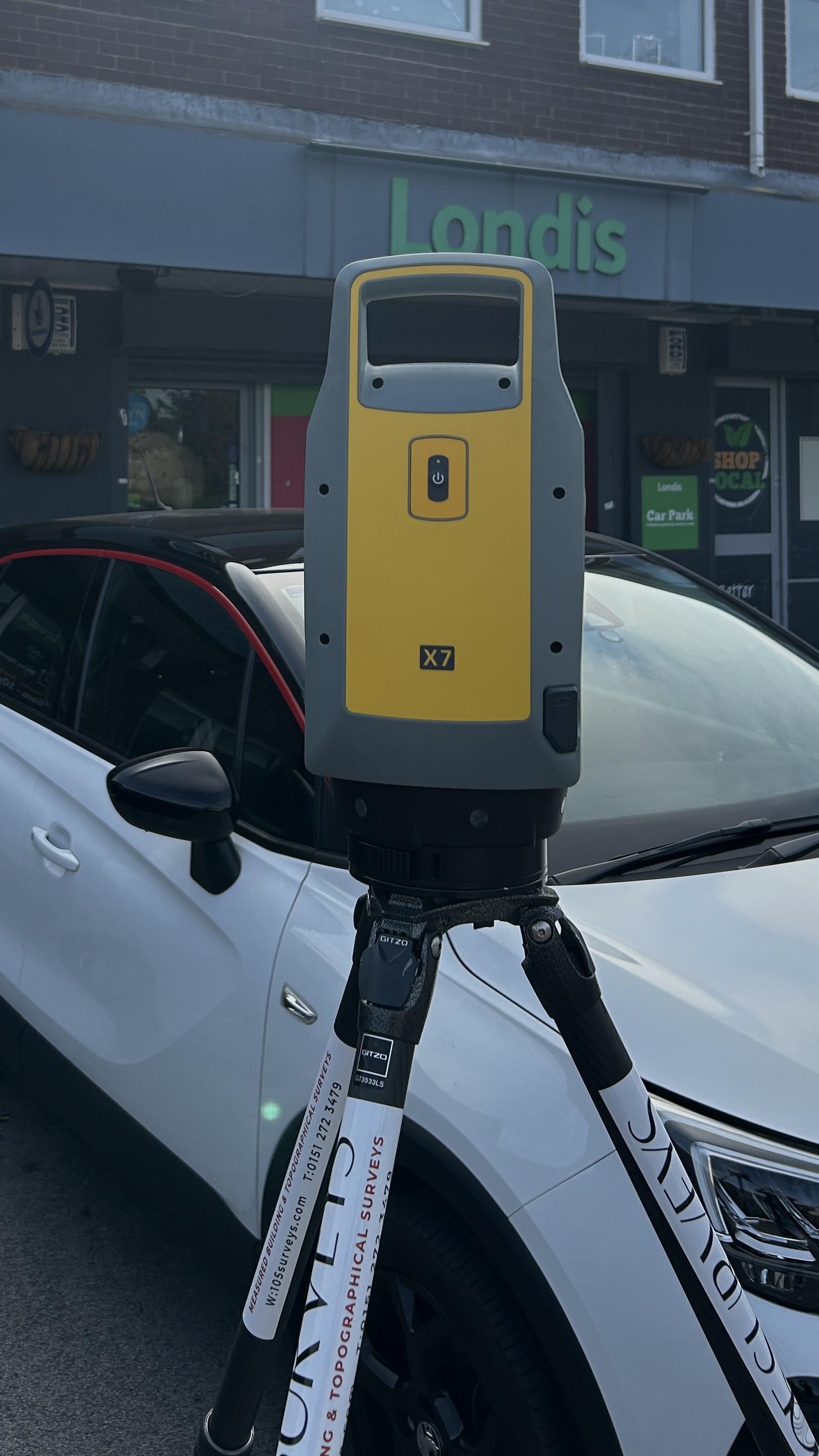
105 Surveys' measured building surveys achieve ±2mm accuracy using Trimble X7 laser scanners — survey-grade equipment that meets strict professional engineering standards. Also known as measured surveys or as-built surveys, every scan is verified before drawings are produced.

All of our measured surveys produce deliverables including 2D CAD drawings and registered point cloud models. Our precise survey outputs provide architects, engineers, and construction teams with the instant, reliable data needed to kickstart any project.

Deliverables include:
  • Floor plans — accurate layouts showing room configurations, walls, openings and dimensions
  • Elevation drawings — true-scaled views of building façades, including windows, doors and architectural features
  • Cross section drawings — cut-through views showing floor levels, heights and structural relationships
  • Roof plans — overhead drawings showing the roof layout, features and drainage arrangements
  • 2D: AutoCAD (.dwg) and vector PDF
  • Registered point cloud (.rcp/.e57)
3D Laser Scanning — Trimble X7 laser scanner used by 105 Surveys for measured building surveys

Point Cloud Surveys For…

Survey-grade point cloud data used by every discipline working on existing buildings.

Architects & Design Teams

  • Accurate existing geometry to design against — proposals fit reality from the first drawing.
  • No return site visits needed to verify dimensions or check details.
  • Clash detection against new proposals done in the model, not on site.

Structural Engineers

  • Spatial conflicts caught before construction starts, not once it’s already on site.
  • Existing geometry verified to ±2mm — design decisions grounded in accurate data.
  • Complex geometry and structural elements captured in full detail.

MEP Consultants

  • Existing services and structure checked against the new design so clashes get spotted early.
  • Accurate routing data for service runs without additional site visits.
  • Full building geometry available from day one of the design process.

Contractors

  • Finished work checked against the design model, giving a clear, timestamped record at handover.
  • As-built verification done from scan data, not manual measurement.
  • Discrepancies identified before sign-off, not after.

Conservation & Heritage

  • Facades, vaulting and fine detail captured to the accuracy conservation plans require.
  • Complex irregular geometry recorded in full before any alterations begin.
  • A lasting record that satisfies planning authorities and conservation officers.

Frequently Asked Questions

A point cloud is a dense set of 3D coordinate data captured by laser scanning equipment. Each point represents a measured location in space. The result is a millimetre-accurate 3D model of the scanned building or site, delivered in formats like .RCP, .RCS or .E57.
We deliver .RCP (Autodesk ReCap), .RCS (ReCap Scan) and .E57 point cloud data as standard. We can also produce AutoCAD drawings and 2D plans, elevations and sections derived from the scan.
Autodesk ReCap, Revit, AutoCAD, Navisworks and most major BIM and CAD platforms support .RCP and .E57 formats. If you use a different platform, let us know and we’ll confirm compatibility.
±2mm using Trimble X7 laser scanners — survey-grade equipment. All scans are registered and verified before delivery.
We cover the full North West region including Liverpool, Manchester, Chester, Warrington, Wigan and Preston. If your project is outside these areas, get in touch and we’ll let you know if we can help.