Topographical Surveys | Preston
Topographical Survey Preston
Accurate land survey data for planning applications and development projects across Preston and Lancashire, delivered fast.
Get a QuoteAccurate land survey data for planning applications and development projects across Preston and Lancashire, delivered fast.
Get a QuoteLancashire's varied topography and Preston's position on the River Ribble means that topographical surveys are a standard requirement for planning applications across the city and the wider county. Preston City Council and Lancashire County Council both expect survey data to accompany applications involving new development, drainage works and external schemes. 105 Surveys delivers topographical surveys across Preston, Chorley, South Ribble, Fylde, Wyre, Ribble Valley, Lancaster and the wider Lancashire area, with data and drawings delivered fast to keep your application and development programme on track.
Every topographical survey we deliver in Preston meets the data standards expected by Preston City Council and is formatted for direct use in planning submissions and design work.
Survey data delivered quickly after site visit, keeping your Preston planning application or development programme on schedule.
We cover Preston and all of Lancashire, with no call-out restrictions across the North West. One call gets your survey booked.
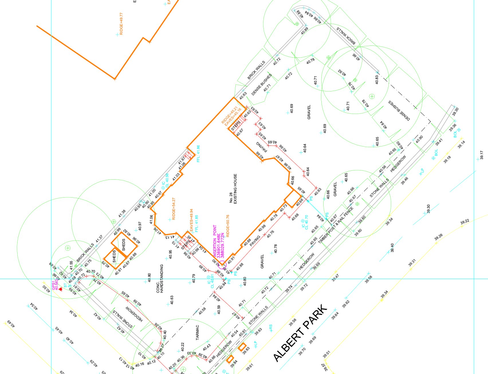
A topographical survey is a detailed measurement of the ground surface — recording existing levels, features, boundaries, services, vegetation and all above-ground structures on and around a site. Planning authorities across Lancashire require this data to understand the existing site conditions before considering any new development proposal.
Preston City Council, South Ribble Borough Council and Chorley Council all require topographical survey data with applications for new development and external works across their respective areas. We ensure every topographical survey delivered in Preston is accurate, correctly formatted and ready to submit with your planning application without amendment.
Topographical survey data is the base on which every new-build and site development design in Preston is built. Without accurate levels and feature data, your design is built on assumptions that will surface as problems during planning or on site.
Preston City Council, South Ribble Borough Council and Chorley Council all require topographical survey data with applications for new development and external works across their respective areas. We work directly with planning consultants across Lancashire to ensure survey data is submitted in the right format, to the right specification, first time.
For residential development land in South Ribble and Fylde, commercial site assessments across Lancashire, drainage surveys and pre-application due diligence across Lancashire, accurate topographical survey data at the front end reduces risk, supports accurate design and prevents costly redesign when issues emerge later in the programme.
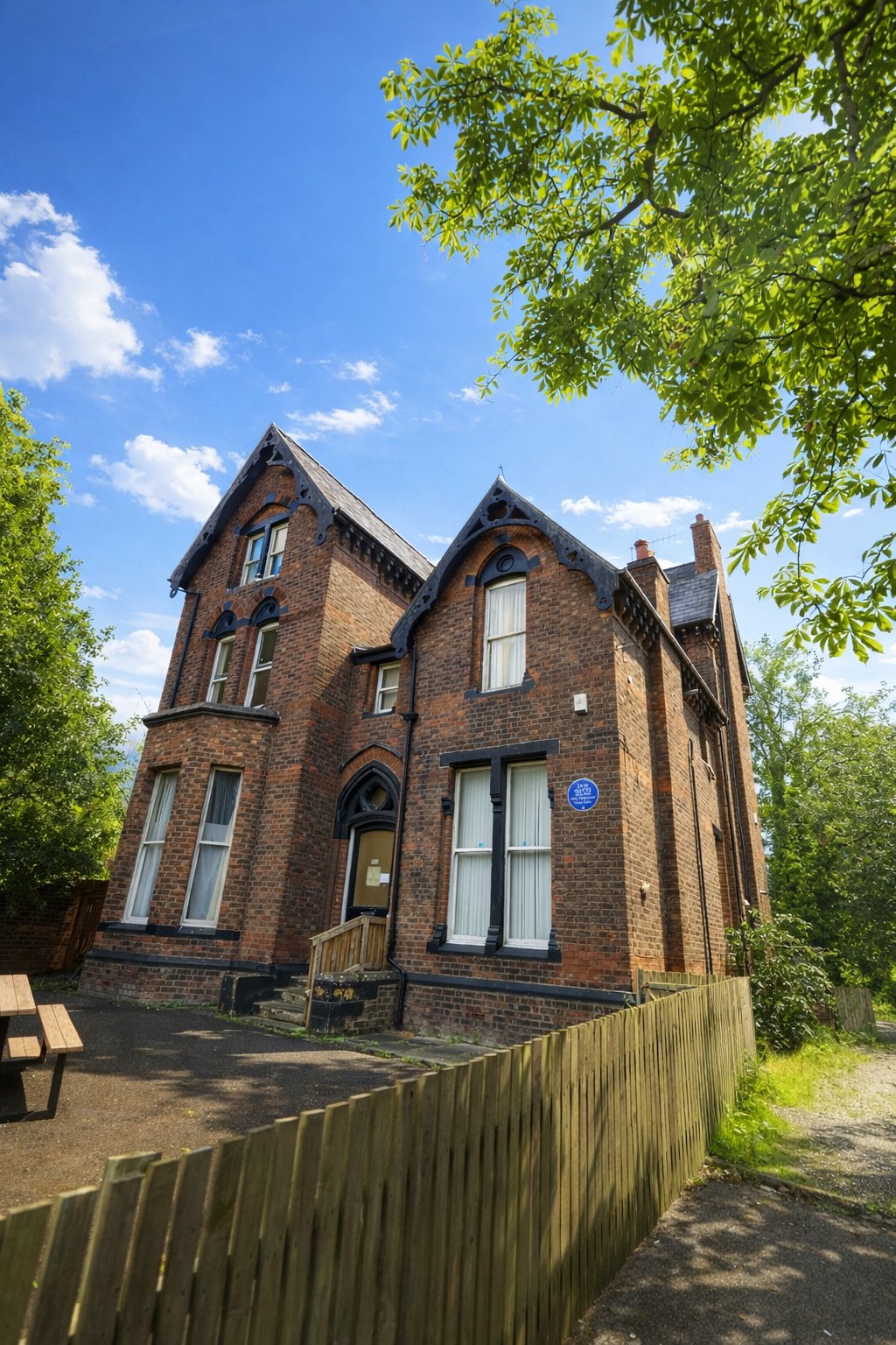
Preston's development market spans a wide range of site types — from brownfield regeneration in the city centre and Riversway Docklands area, to suburban residential development across Fulwood, Penwortham and Longridge, to greenfield and agricultural land in the wider Lancashire countryside. Each of these site types requires topographical survey data, but the scope differs significantly. City centre brownfield sites typically need detailed utility and drainage records; suburban residential sites need accurate boundary and highway interface data; greenfield sites need contour surveys across larger areas with vegetation, watercourse and flood risk data.
Preston City Council requires topographical survey data to accompany planning applications for new development, including residential and commercial schemes. The Riversway Docklands Enterprise Zone has generated significant planning activity — large brownfield development sites requiring detailed topographical data for infrastructure planning, drainage strategy and flood risk assessment. The River Ribble, which runs along Preston's southern boundary, places a large portion of the city within flood risk zones where topographical survey data is a planning requirement.
The wider Lancashire market — Chorley, Leyland, Longridge, Clitheroe and the Ribble Valley — generates consistent demand for topographical surveys from planning consultants working on agricultural barn conversions, rural residential plots and local authority infrastructure schemes. We cover all of these areas and can mobilise quickly for pre-application surveys where planning programmes are time-critical.
We cover Preston city centre, Fulwood, Penwortham, Leyland, Chorley, Longridge, Clitheroe and the wider Lancashire area. Get in touch with your site details and we will provide a fixed-price quote within 24 hours and confirm site attendance at the earliest available date.
We cover Preston and surrounding areas including Chorley, Blackburn, Lancaster, Leyland and the Ribble Valley, and more across Lancashire. We also deliver topographical surveys across the wider North West. Call 0151 272 3479 or email info@105surveys.com to see how we can help with your project.