Topographical Surveys | Warrington
Topographical Survey Warrington
Accurate land survey data for planning applications and development projects across Warrington and Cheshire, delivered fast.
Get a QuoteAccurate land survey data for planning applications and development projects across Warrington and Cheshire, delivered fast.
Get a QuoteWarrington sits on the River Mersey with a mix of urban development sites and strategic greenfield land across the borough. Warrington Borough Council expects topographical surveys to accompany planning applications for new development schemes, and the borough's ongoing growth programme means demand for survey services here is consistently high. 105 Surveys delivers topographical surveys across Warrington, Halton, Cheshire East, St Helens, Wigan and the wider Cheshire area, with data and drawings delivered fast to keep your application and development programme on track.
Every topographical survey we deliver in Warrington meets the data standards expected by Warrington Borough Council and is formatted for direct use in planning submissions and design work.
Survey data delivered quickly after site visit, keeping your Warrington planning application or development programme on schedule.
We cover Warrington and all of Cheshire, with no call-out restrictions across the North West. One call gets your survey booked.
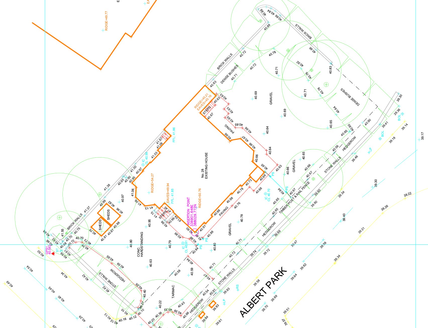
A topographical survey is a detailed measurement of the ground surface — recording existing levels, features, boundaries, services, vegetation and all above-ground structures on and around a site. Planning authorities across Cheshire require this data to understand the existing site conditions before considering any new development proposal.
Warrington Borough Council and Halton Borough Council both require topographical survey data with applications for new development, particularly on sites within the borough's strategic housing and employment growth zones. We ensure every topographical survey delivered in Warrington is accurate, correctly formatted and ready to submit with your planning application without amendment.
Topographical survey data is the base on which every new-build and site development design in Warrington is built. Without accurate levels and feature data, your design is built on assumptions that will surface as problems during planning or on site.
Warrington Borough Council and Halton Borough Council both require topographical survey data with applications for new development, particularly on sites within the borough's strategic housing and employment growth zones. We work directly with planning consultants across Cheshire to ensure survey data is submitted in the right format, to the right specification, first time.
For residential growth zone sites, commercial land assessments across Birchwood and Gemini, drainage surveys and pre-application due diligence for strategic development sites across Cheshire, accurate topographical survey data at the front end reduces risk, supports accurate design and prevents costly redesign when issues emerge later in the programme.
Warrington sits at the heart of the North West's logistics and distribution network — the M6, M56 and M62 converge within the borough, making it one of the most active commercial development zones in the region. Commercial and industrial development along these corridors generates consistent demand for topographical surveys as a pre-application requirement. Sites in this sector tend to be large, flat, and operationally complex — existing infrastructure, drainage ditches, access roads and utility apparatus all need accurate recording before a planning application or pre-application consultation can progress.
Warrington Borough Council requires topographical survey data to accompany planning applications for new development and significant external works. The town's position between the Mersey and the Manchester Ship Canal means that many development sites fall within designated flood risk zones. Topographical survey data is the essential starting point for the Flood Risk Assessment that planning policy requires for sites in these areas.
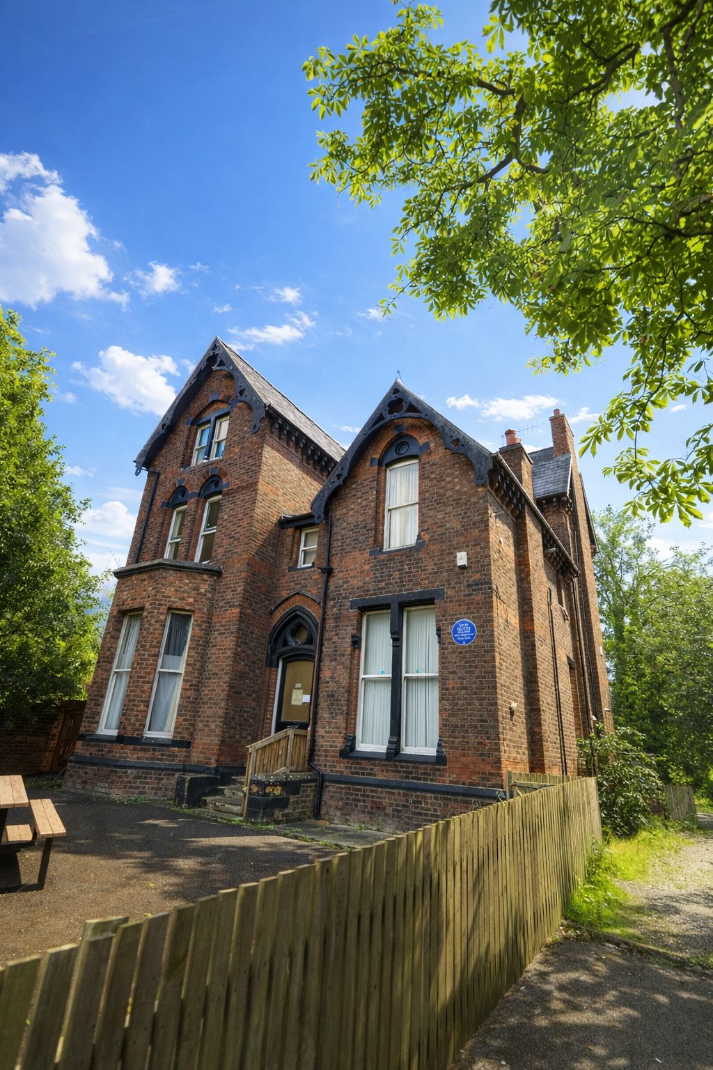
The Stockton Heath and Appleton areas to the south of the town centre have a more residential development character — garden plots, backland sites and suburban infill where accurate boundary and level data is the first deliverable. We cover all site types across the borough, from large commercial plots on the M62 corridor to single residential plots in the Stockton Heath conservation area.
We cover Warrington town centre, Stockton Heath, Penketh, Lymm, Padgate, Birchwood, Culcheth and the wider Warrington Borough for topographical surveys. Warrington is midway between our Liverpool base and Manchester — we can mobilise quickly and provide a fixed-price quote within 24 hours of receiving your site details.
We cover Warrington and surrounding areas including Runcorn, Widnes, Lymm, Halton and Stockton Heath, and more across Cheshire. We also deliver topographical surveys across the wider North West. Call 0151 272 3479 or email info@105surveys.com to see how we can help with your project.